The weather has once again taken a turn in many states of North India. Due to the activity of Western Disturbance, there is light rain at some places and strong thunderstorms at other places in Uttar Pradesh, Bihar, Rajasthan and hilly states including the capital Delhi. The Meteorological Department (IMD) has issued yellow and orange alerts in many parts for the next 24 to 48 hours.
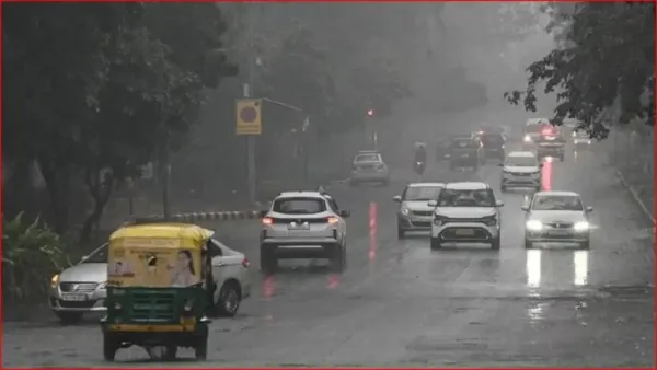
Light drizzle in the country’s capital Delhi on Friday has provided considerable relief from the heat. Delhi is expected to be partly cloudy on Saturday (28 March). Today the maximum temperature is likely to be around 32 degrees Celsius and the minimum temperature is likely to be around 18 degrees Celsius.
However, this process of relief will not stop here. According to the Meteorological Department, there may be thunderstorms and moderate rain with strong winds (30-40 km/hr) in Delhi on Sunday, for which a yellow alert has been issued. The temperature is expected to remain below normal for the next one week.
The trend will change again in UP from tomorrow
Weather fluctuations continue in Uttar Pradesh. On March 28, most of the districts of the state are in the Green Zone, that is, today the weather will be mainly normal and it will be sunny. The maximum temperature in Lucknow is expected to be around 33 degrees. The situation will be normal in Noida and Ghaziabad today, but after the next 24 hours, cloud movement and drizzle may start here too. There is a possibility of return of rain with strong winds in some districts of Western UP from tomorrow.
Storm and rain increased concern, damage to crops
The most extreme form of weather has been seen in Bihar. On Friday night, winds and rain at a speed of 50 to 70 km per hour disrupted life in 34 districts including Patna. At many places, power supply was disrupted due to falling of trees and hailstorm caused huge damage to crops. There is a possibility of rain and thundershowers in almost all the districts of the state on Saturday also.
Orange alert has been issued in Jharkhand today especially in 10 districts, most of which are in the southern and central districts. Like Chatra, Ranchi, Khunti, Ramgarh, Seraikela Kharsawan, Hazaribagh, Latehar and Lohardaga. Strong lightning and storm can be seen in these districts today.
Condition of hill states: signs of snowfall and rain
A drop in temperature has been recorded in Shimla and Kullu-Manali of Himachal Pradesh. Between March 28 and 30, there are chances of light to moderate rain in many parts of the state and snowfall on higher peaks. At the same time, the weather will continue to fluctuate in districts like Uttarkashi, Chamoli and Pithoragarh of Uttarakhand till April 2. There is a possibility of snowfall in areas at altitude above 3300 meters.
Rajasthan, Haryana and MP: Dust storm and rain
There is a possibility of thunderstorm and rain in Jodhpur and Bikaner divisions in Rajasthan on Saturday afternoon. On March 29-30, winds may blow at a speed of 50 km/hr in many divisions including Jaipur and Ajmer. In Haryana, yellow alert has been issued across the state for March 29 and 30. There has been a warning of lightning and sporadic rain in many districts of Madhya Pradesh including Gwalior, Jabalpur and Rewa.
Special advice for farmers
In view of this sudden change in the weather, agricultural scientists have asked farmers to take special precautions. Keep the harvested crops and grains kept in the barn covered in safe places. For now, postpone irrigation and spraying of pesticides. Do not take shelter under tall trees and electric poles during a storm.
Contact to : xlf550402@gmail.com
Copyright © boyuanhulian 2020 - 2023. All Right Reserved.